New Jersey has less public land to lose than almost any state in the country. The largest sea of public land that residents can still drive into to fish, camp, hunt and explore has already lost more than half its mapped roads. Now a bill in Congress would put the rivers running through it under federal study as a Wild and Scenic River designation.
Wharton State Forest:
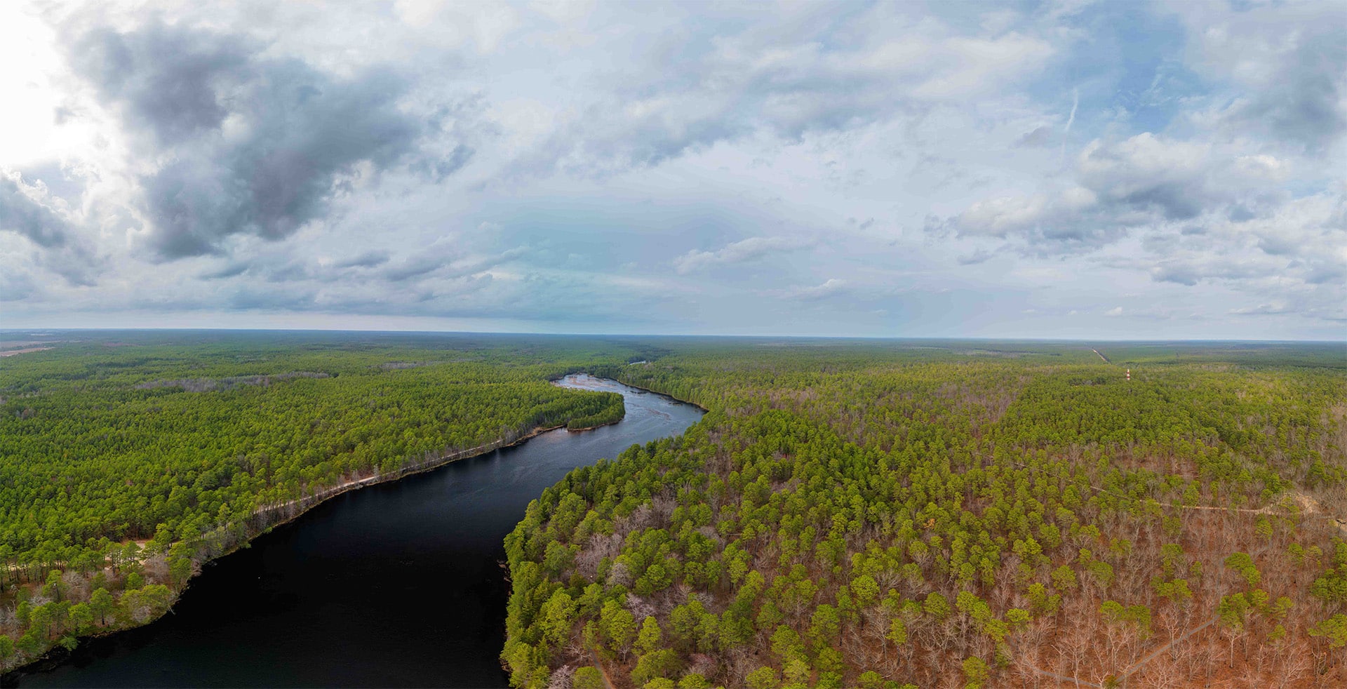
Wharton State Forest covers more than 120,000 acres in the Pine Barrens and is the largest single property in New Jersey's state park system. For generations, its roads have taken visitors to the Mullica, Batsto, Wading and Oswego rivers and to campsites, ponds and historic sites like Batsto Village. Families have used those roads to reach canoe launches, fishing holes and hunting grounds, and just to explore the Pines on 4x4s and on motorcycles and enjoy the great outdoors.
In 2015, the New Jersey Department of Environmental Protection (DEP) began a Motorized Access Plan for Wharton. The public pushed back hard against its road closures and proposed permit system, and the plan stalled. In January 2024, DEP released a Visiting Vehicle Use Map that recognized only about 200 miles of roads. BRC opposed the map and asked our members to comment before the March 9, 2024 deadline.
The Pinelands Commission had mapped about 510 miles of potential roads in the forest. DEP dismissed about 120 miles as unusable and excluded roughly 190 more for being too close to sensitive areas. After public comment, the current map opens 233 miles to all visitors, plus 37.1 miles of hunting-only roads that require a Hunter Access Pass. Any road left off the map is closed to vehicles, and fines start at $500 for a first offense.
The Mullica River Wild and Scenic River Study Act:
On May 20, 2026, Rep. Herb Conaway Jr. (NJ-3) and Rep. Jeff Van Drew (NJ-2) introduced the Mullica River Watershed Wild and Scenic River Study Act of 2026 (H.R. 8924) in the U.S. House. Sens. Andy Kim and Cory Booker introduced the Senate companion (S. 4595). The House bill was referred to the Natural Resources Committee.
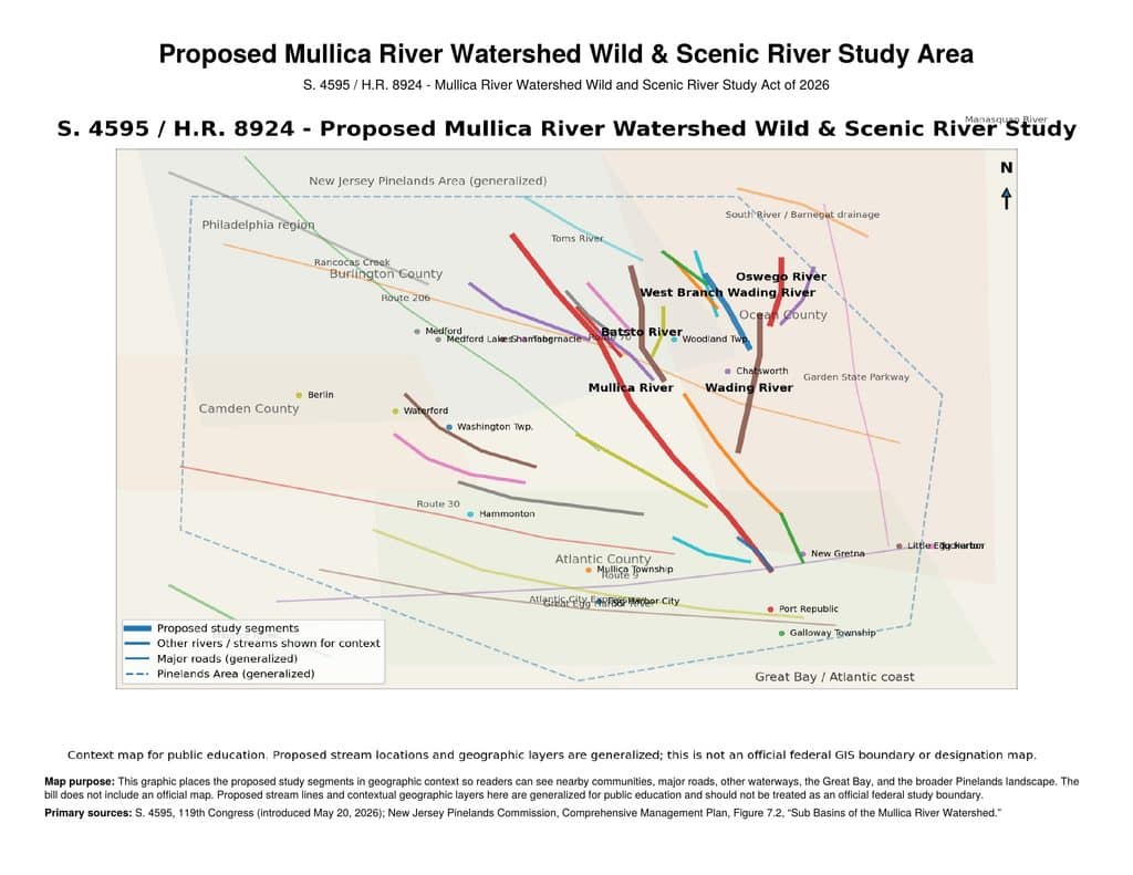
The bill would amend the federal Wild and Scenic Rivers Act to have the Secretary of the Interior study "the segments of the Mullica River, Wading River, Batsto River, and the tributaries of each such river within the Mullica River watershed" for possible designation. It names 23 segments, including:
- the Mullica from its headwaters to Great Bay
- the Batsto, Oswego and West Branch Wading rivers
- Skit Branch, Springers Brook, Tulpehocken Creek, Bass River and Nescochague Creek
The study would be due within three years after Congress funds it. The Pinelands Alliance and other groups are backing the effort. Much of this water runs through Wharton State Forest, on the same stretches the road closures already affected.
How Wild and Scenic designations restrict access
Supporters claim a study is harmless, but that's not the whole truth. Under the Wild and Scenic Rivers Act, restrictions can start as soon as a river is listed for study:
- Restrictions during the study. Section 7(b) of the Act bars federal assistance, licenses or permits for water resources projects that would directly and adversely affect a study river's values. Bridges, culverts, road crossings, boat ramps and bank repairs often need a federal permit, such as an Army Corps Section 404 permit. Those projects would face National Park Service review while the study is underway.
- A "wild" classification rules out roads. The Act defines "wild" rivers as "generally inaccessible except by trail." Even "scenic" rivers are "largely undeveloped" and only "accessible in places by roads." Any segment given either label creates pressure against the roads that reach it.
- Visitor capacity limits. Designated rivers need a comprehensive river management plan that addresses "user capacities." Planners routinely use that requirement to justify permits, quotas, and limits on parking and access points.
- Wide corridors. Designated boundaries can average up to 320 acres per river mile. Across 23 segments, that could put a large share of the Wharton landscape inside a federal river corridor.
- Another reason to close roads. DEP already used proximity to sensitive areas to leave roads off its map. A federal designation built around protecting "outstandingly remarkable values" gives agencies and advocacy groups one more basis for the next round of closures.
The Pine Barrens are already protected by the Pinelands National Reserve, the Pinelands Comprehensive Management Plan and state forest rules. The Mullica doesn't need another layer of management. Visitors need to keep the access that's left.
How little access New Jersey has left
- Federal land is scarce. The federal government owns 183,084 acres in New Jersey, 3.8% of the state, according to the Congressional Research Service.
- Very little public land per person. Federal land plus the roughly 453,786 acres of state parks and forests totals about 637,000 acres, around 13% of the state. New Jersey had 9,288,994 residents in the 2020 Census. That works out to about 3,000 square feet of federal and state park land per resident, about the size of a single tennis court.
- Wharton is a big share of it. Wharton is about 27% of the entire state park system, so what happens there affects a large part of what New Jersey residents have access to enjoy.
- More than half the roads are gone. Of the roughly 510 miles of roads the Pinelands Commission mapped, 233 remain open to everyone. That's fewer than half, about the same as closing every other road in the forest.
- No place to ride. In 2013, DEP opened the Mount Pleasant State Off-Road Vehicle Park, describing it as the state's first state-owned ATV park and noting that "ATV use remains illegal on all other state-owned lands." It started with about 10 riding acres on a former sand mine, and it has since closed. New Jersey no longer has a state-run place for ATVs or dirt bikes on public land.
One push, different tools
The state closed most of Wharton's roads to protect areas near the water. A federal study would now place water access under a law that treats roads near "wild" rivers as a problem, allows limits on visitor numbers, and adds review for bridges and crossings. Each step is presented as modest, and each one leaves the public with less.
A state with this little public land can't keep giving it up. When access shrinks, the same number of people crowd onto fewer acres, which brings more impact, more conflict and more enforcement. New Jersey residents already cross state lines to ride. Education, maintenance and enforcement of existing rules should come before any new closure or federal designation.
<div
  class="muster-embed muster-embed-action"
  data-action-center-id="eea9835e-d5e5-48b0-8094-784a6c215bb5"
  data-domain="https://mstr.app"
  data-height="1000"
  data-width="100%"
  data-height-full="true"
  data-css=""
  id="muster-widget-v2-action-center-eea9835e-d5e5-48b0-8094-784a6c215bb5"
>
  <script
    src="https://widgets.muster.com/v2/action-center-20240730.js"
    widget-id="muster-widget-v2-action-center-eea9835e-d5e5-48b0-8094-784a6c215bb5"
  ></script>
</div>