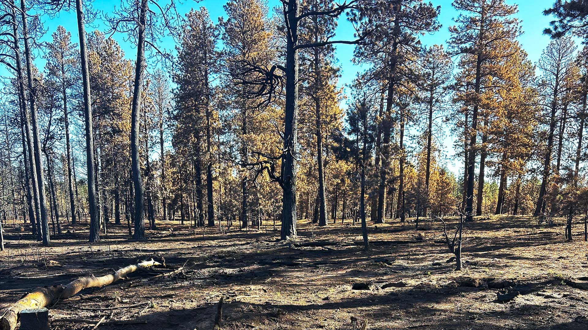
BlueRibbon Coalition (BRC) supports the thinning, regeneration, and prescribed burning proposed in the Big Piney Vegetation Management Project on the Warm Springs Ranger District of the George Washington National Forest in Virginia. BRC routinely asks the agencies to keep the temporary roads it builds or reopens for that work instead of ripping, berming, and blocking all of them when the work ends. This project proposes to decommission existing roads that could be used for public access. Comments are due by 11:59 p.m. Eastern on November 30, 2026.
What the Forest Service proposes
The January 2026 Draft Environmental Assessment (EA) affects 14,904 acres of National Forest System land in Bath County, Virginia, northeast of Hot Springs, in the Muddy Run and Jordans Run area. You can find more information at the project page.
- 675 acres of regeneration harvest and 1,544 acres of thinning, all in Forest Plan Management Area 13 (Mosaics of Wildlife Habitat)
- 462 acres of forest stand improvement
- 7,161 acres of prescribed burning in seven blocks, with up to 3.7 miles of dozer line and 17 miles of hand line
- 23 wildlife openings totaling 47 acres, and 11 waterholes
- 5 aquatic organism passage crossings and large woody debris placement in streams
- 27 miles of skid trails, 92 landings, and 8.3 miles of temporary road (6.0 miles existing, 2.3 miles new)
The need is structural. About 12,140 acres of the project area are closed-canopy forest, and only about 374 acres are early successional habitat. The EA's departure analysis puts oak systems 73 percent away from the Forest Plan's desired condition and pine systems 84 percent away. After treatment, the EA projects early successional habitat rising to 1,728 acres, open woodland rising from 412 to 3,184 acres, and closed woodland falling from 12,140 to 7,973 acres. Eleven old growth patches totaling 43.9 acres are excluded from harvest.
Why BlueRibbon Coalition comments on vegetation projects
If a forest goes up in flames, it’s inaccessible and unsafe for years after the fire. It is important to BRC for vegetation treatments move forward in order to keep the forests healthy, safe, and accessible. A vegetation project often includes decisions about future access to the area. When the work ends, the road network is different, and the decision determines which roads can still be used by the public. Timber and fuels projects are where many access closures get decided, which is why we regularly add the voice of recreation users to these projects. In almost every case, BRC is the only organization addressing recreation access concerns in these plans.
BRC does not object to building temporary roads where they are needed to do the work. BRC always asks the agency to keep those roads in the transportation system instead of decommissioning them, because decommissioning costs money, disturbs ground a second time, and removes a road that fire crews and the public can use.
What the Big Piney Project does with the roads
The Big Piney EA authorizes the roads as temporary and then closes all of them. Under the design criteria, temporary roads, skid roads, and landings are closed to vehicles, ripped or de-compacted where needed (the EA says that may mean tilling to six inches or more), seeded, mulched with certified weed-free material, and stripped of their drainage structures. The EA adds that closures may use slash, ditching, "tank traps," or boulders to prevent unauthorized use. Timber sale contracts must require the purchaser to treat temporary roads so vegetation can reestablish, by artificial or natural means, within 10 years after the contract ends (36 CFR 223.37). Natural regrowth satisfies that text. Ripping, berms, tank traps, and boulders are the district's choices. A temporary road is one authorized by contract that is not a forest road and not part of the forest transportation system (36 CFR 212.1).
The EA also shows that the district expects to keep using some of these roads.
- A 0.5-mile section of the decommissioned portion of Jordan's Run Road (FR 358) would be used to reach units and would stay in use for prescribed burning after it is bermed and closed to the public.
- Some temporary roads would continue to be used to reach wildlife openings. The EA's aquatics section says those routes must be recognized as permanent access and built and stabilized that way.
- Prescribed fire crews would use roads, streams, and skid trails as control lines where practicable, and the EA still builds up to 3.7 miles of dozer line and 17 miles of hand line on top of them.
What closing the roads costs, what keeping them costs, and what the roads are worth
The Big Piney EA does not put a dollar figure on closing 8.3 miles of temporary road, on keeping any of it, or on the recreation those roads serve. BRC created the estimates below from public Forest Service data, so the district can check them and replace them with its own. We want district to analyze all three in the EA.
Estimate 1: Closing the roads (one-time cost)
- Ripping the roadbed costs $400 to $1,200 per kilometer in a 2004 Forest Service-hosted review of road removal methods (Switalski et al., citing Bagley 1998). Adjusted to 2024 dollars with the Consumer Price Index, that is about $1,240 to $3,720 per mile, or $10,300 to $30,800 for 8.3 miles.
- A larger closure costs more. A Legacy Roads and Trails project on the Clearwater National Forest in Idaho retired about 33 miles of road, restored much of the original grade, armored the larger stream channels, and replanted native vegetation. It cost at least $262,000 ($212,000 from a tribe and a resource advisory committee plus $50,000 from the Legacy program), or about $7,900 per mile. The report does not give a year. Treating the figures as 2008 dollars, that is about $11,600 per mile in 2024 dollars, or about $96,000 for 8.3 miles. The EA does not propose full recontouring, so this is a high-end comparison.
- Stream crossings add to either figure. The 2004 review lists $500 to $150,000 per crossing. The EA identifies at least 11 potential perennial channel crossings in the access network and temporary culverts or bridges in at least eight units, and it does not say how many fall on the 8.3 miles.
- The EA requires seeding, weed-free mulch, slash cover, berms and barriers, three years of monitoring, and herbicide follow-up, and it prices none of them. It applies the same closure design to 27 miles of skid trails and 92 landings, which the figures above leave out.
Our estimate for the 8.3 miles of road alone is roughly $10,000 to $100,000 before stream crossings. Under the timber sale contract the purchaser pays for this work, and purchasers account for contract costs when they bid, which can lower what the Forest Service collects for the timber.
Estimate 2: Keeping the roadbeds (annual cost)
Maintenance Level 1 stores a road closed to vehicles with basic custodial care. It keeps the roadbed available for burns and emergencies and does not open it to the public. Maintenance Level 2 maintains a road for high-clearance vehicles, and public motor vehicle use on it still requires designation on the motor vehicle use map under the Travel Management Rule (36 CFR part 212, subpart B).
- Maintenance Level 1: the Pisgah National Forest in North Carolina, which is in the same Forest Service Southern Region as the George Washington, estimated $150 per mile per year in its 2012 transportation analysis, and the Dolores Ranger District of the San Juan National Forest in Colorado estimated $246 in 2015. In 2024 dollars that is $205 to $326 per mile, $1,700 to $2,700 per year for 8.3 miles, and $51,000 to $81,000 over 30 years.
- Maintenance Level 2: the Forest Service Pacific Northwest Region estimated $431 in 2014 and Pisgah estimated $1,200 in 2012. In 2024 dollars that is $571 to $1,640 per mile, $4,700 to $13,600 per year for 8.3 miles, and $142,000 to $408,000 over 30 years.
- These are agency estimates of the annual need, not what the agency spends. BRC is not suggesting the district to build passenger-car roads, which the Pacific Northwest estimate puts at $8,100 to $15,600 per mile per year in 2014 dollars (Maintenance Levels 3 and 4).
- Reopening a closed road costs more. A new dirt road costs roughly $80,000 to $100,000 per mile excluding major drainage structures (Pew Charitable Trusts, October 5, 2026), which is $664,000 to $830,000 for 8.3 miles. The EA gives no number for reopening a ripped roadbed, and it says about 0.75 mile of old, grown-in roadbed needed daylighting, grading, and graveling before it could carry haul traffic. The EA calls for burning on a 4 to 12 year return interval, which means the roads could see additional administrative use 2-7x over 30 years.
On cash cost alone, closing the roads may be the cheaper path if the roads are never needed again. Thirty years of Maintenance Level 2 upkeep ($142,000 to $408,000) exceeds the closure estimate ($10,000 to $100,000). The comparison reverses if the district needs any of the roads again, because rebuilding 8.3 miles at new-road cost ($664,000 to $830,000) exceeds every upkeep total above. Since the EA indicates the roads will be used again, the economics favor upkeeping the roads over reclaiming them.
Estimate 3: What road-based recreation is worth
BRC's October 6 review values road-dependent national forest recreation two ways: what a visitor day is worth to the visitor, and what visitors spend in nearby communities.
- Value per visitor day, from the Forest Service's own visitor survey data (Bowker et al. 2009, national values, 2025 dollars): OHV use $110, camping $34, hunting $98, hiking $162.
- Local spending: visitors to the George Washington and Jefferson National Forests spend about $69.1 million a year across about 1,770,000 visits, which is about $39 per visit (Forest Service Benefits to People report, 2018). BRC's review uses $64.74 per visit nationally in 2024 dollars. Each million visits supports about 770 jobs and $42 million in labor income nationally.
- Use on these roads: the district should have the visit counts, including the Forest Service's National Visitor Use Monitoring survey for these forests and the motor vehicle use map, and BRC does not have road-level numbers. For scale, 8.3 miles is 0.27 percent of the 3,030 miles of road on the two forests, which would be about 4,800 visits a year if use were spread evenly by road mile.
At three levels of use, counting one visit as one day:
- 500 visits a year: $17,000 to $55,000 in value to visitors (camping rate to OHV rate), $20,000 to $32,000 in local spending, and about 0.4 job.
- 2,500 visits a year: $85,000 to $275,000 in value to visitors, $98,000 to $162,000 in local spending, and about 2 jobs.
- 5,000 visits a year: $170,000 to $550,000 in value to visitors, $195,000 to $324,000 in local spending, and about 4 jobs.
Value to visitors is not money the Forest Service collects, so while it shouldn't be added to the cost figures, USFS should still analyze this. The Maintenance Level 2 upkeep estimate of $4,700 to $13,600 a year equals the value to visitors of 43 to 124 OHV days a year at $110 a day. If the district's own counts and costs fall outside these ranges, the EA should say where and why.
Volunteers can do the maintenance work, and the agency has the tools to use them
In fiscal year 2024 the Forest Service mobilized more than 82,000 volunteers who gave 2.4 million hours of service valued at nearly $80 million. The agency's own volunteer program works through volunteer service agreements, including group agreements, and a volunteer may operate a government vehicle when the agreement authorizes it and the volunteer is trained and certified like an employee. However, more and more BRC is getting reports from members and groups that the agencies are pulling their volunteer service agreements and making it harder and harder to do volunteer work on our public lands.
The Big Piney EA does not mention volunteers, partners, or cooperators anywhere in its roads analysis, its design criteria, or its list of organizations consulted. It does not say whether the district asked any club to help keep roads open. The EA describes declining road-maintenance funds.
What BRC asks the district to do
- Analyze an alternative that retains temporary roadbeds as system roads at Maintenance Level 1 or 2 and treats each segment by risk: no treatment on low-risk ridge and bench roads, waterbars or dips on moderate segments, and removal of culverts and fills at stream crossings. Start with the 0.5-mile segment of FR 358 and the routes that serve wildlife openings.
- Disclose the per-mile cost of each closure treatment, who pays it, and what it costs to reopen a closed roadbed for later burns or maintenance.
- Disclose closure monitoring for this district and forest, including how often berms, barriers, and trenches have been breached.
- Reconcile the 8.3, 9, and 3 mile figures for temporary road, and state the actual status of FR 358.
- Offer road maintenance to motorized clubs and other volunteer groups under volunteer or cooperative agreements, and say in the decision that it will.