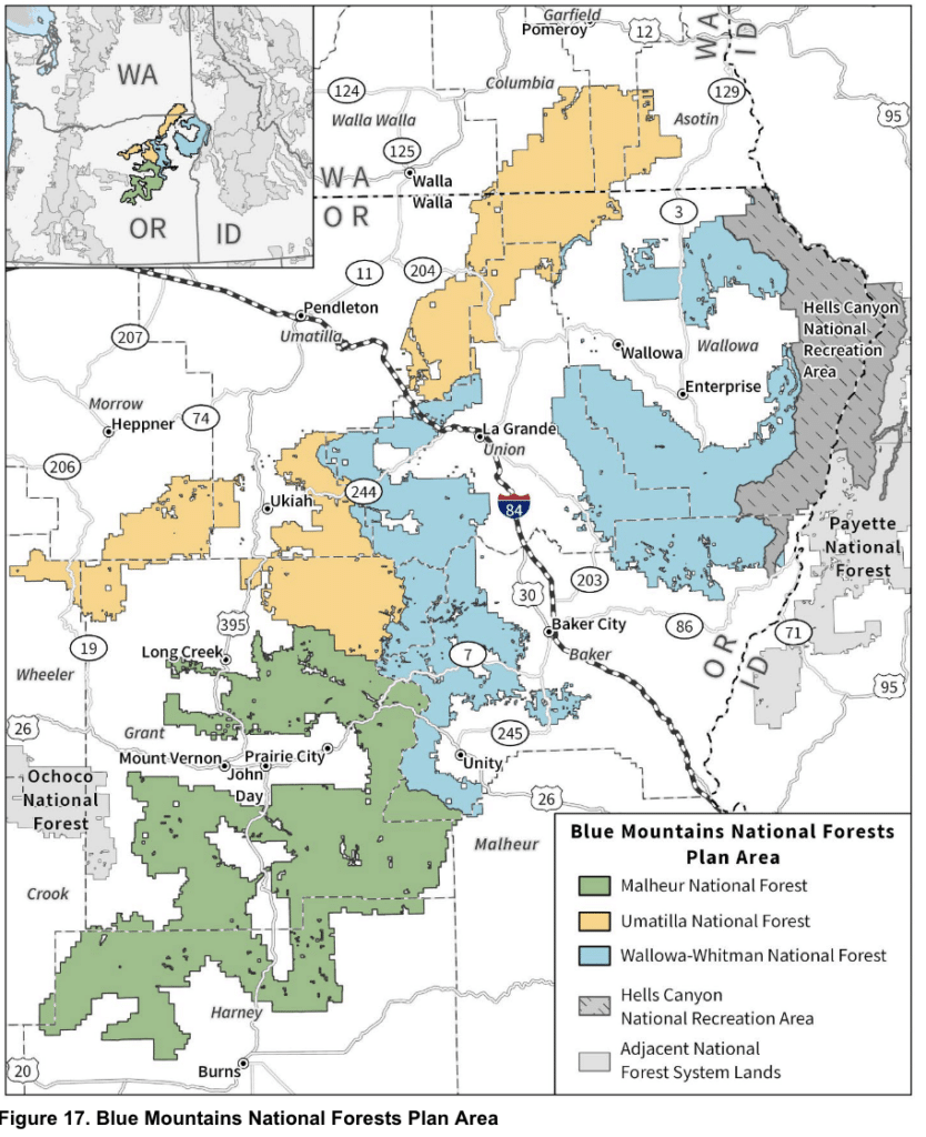
The U.S. Forest Service has released its Draft Environmental Impact Statement (DEIS) for the Blue Mountains Forest Plan Revision, covering the Malheur, Umatilla, and Wallowa-Whitman National Forests. This is the first full rewrite of these forest plans since the 1990s, and it will set the management direction for roughly 5 million acres for decades to come.
What's Being Proposed
The DEIS evaluates three different alternatives:
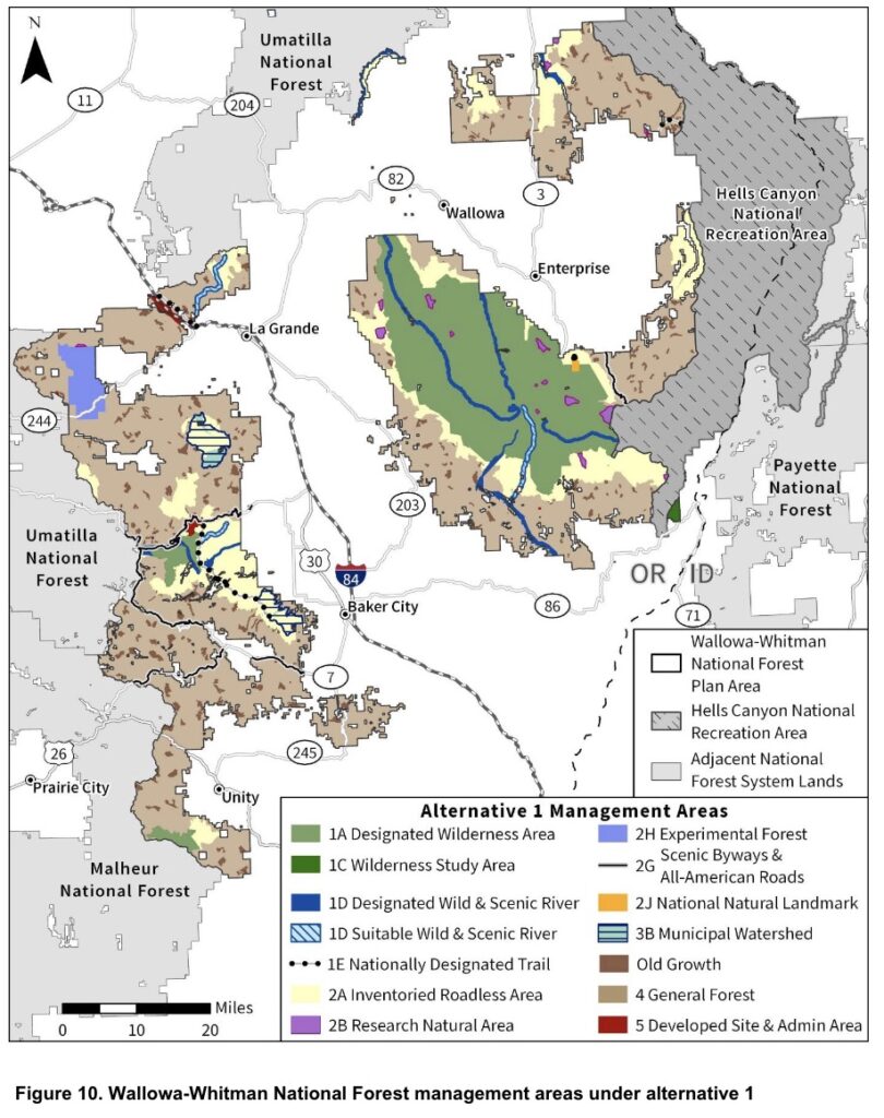
Alternative 1 — No Action: Continue the 1990s Plans This is the baseline required by law: what happens if the forests simply keep operating under their current plans. It freezes today's designations in place — no new wilderness recommendations, but also no relief from the roughly 722,000 acres currently managed as Inventoried Roadless Areas across the three forests. Timber output and job impacts are the lowest of the three alternatives.
Alternative 2 — Proposed Action: Active Management This is the Forest Service's proposed action and the alternative most aligned with access and multiple use. It recommends no new wilderness and analyzes the plan area as if the Roadless Rule no longer applied — which would open roughly 722,000 acres of currently roadless land to road access and forest management as General Forest. It also projects by far the highest timber output, the most jobs (3,050 total), and the highest labor income ($240 million) of the three alternatives.
Alternative 3 — Active Management with Additional Resource Considerations Alternative 3 keeps most of Alternative 2's active-management framework but layers on significant new restrictions. It recommends about 34,000 new acres of wilderness, retains the full ~722,000 acres of roadless-area restrictions that Alternative 2 would lift, and expands Wild & Scenic River corridor mileage. It also drops a targeted-grazing objective that Alternative 2 includes for fuels and invasive species work. Projected jobs (1,415) and timber output fall to less than half of Alternative 2's levels.
Alternative Comparison at a Glance
Here's the cleaned-up table without the MA codes:
| Designation | Alt 1 | Alt 2 | Alt 3 |
|---|---|---|---|
| Designated Wilderness | 759,500 acres | 759,500 acres | 759,500 acres |
| Recommended Wilderness | 0 acres | 0 acres | 34,058 acres |
| Wilderness Study Area | 2,370 acres | 2,370 acres | 2,370 acres |
| Wild, Scenic & Recreational River corridor | 267 miles | 375 miles | 375 miles |
| Inventoried Roadless Area | 722,200 acres | 0 acres | 722,200 acres |
| Research Natural Area | 29,990 acres | 29,990 acres | 29,990 acres |
| Total acres in restrictive designations* | 1,514,060 acres | 791,860 acres | 1,548,118 acres |
Source: Draft EIS, Blue Mountains Forest Plan Revision (July 2026), Tables 2–5, 14–16, 22–24.
Why This Matters for the Recreation Community
Recommended wilderness and roadless-area retention aren't abstract planning categories — they come with concrete, on-the-ground consequences for how these forests can be used and managed. Under Alternative 3's new wilderness recommendations, motorized and mechanized use of any kind, including OHVs and mountain bikes, would be prohibited, and timber harvest or mechanical fuels treatment would no longer be an option. The DEIS is candid about the trade-off it's making:
"Limiting mechanized and motorized activities, such as mountain biking and off-highway vehicle use, would reduce disturbance to wildlife and trampling of plant populations and habitats." — Draft EIS, Substantive Issue 4: Recommended Wilderness
The same section acknowledges that without active management, these acres would carry a "higher risk of high-severity wildfires," and that threats from insects, drought, and disease "would remain unaddressed." Similar trade-offs apply to the roadless-area comparison: the agency's own analysis notes that areas kept off-limits to new roads "would continue to support high-severity fire behavior," while Alternative 2's approach would allow faster treatment of hazardous fuels.
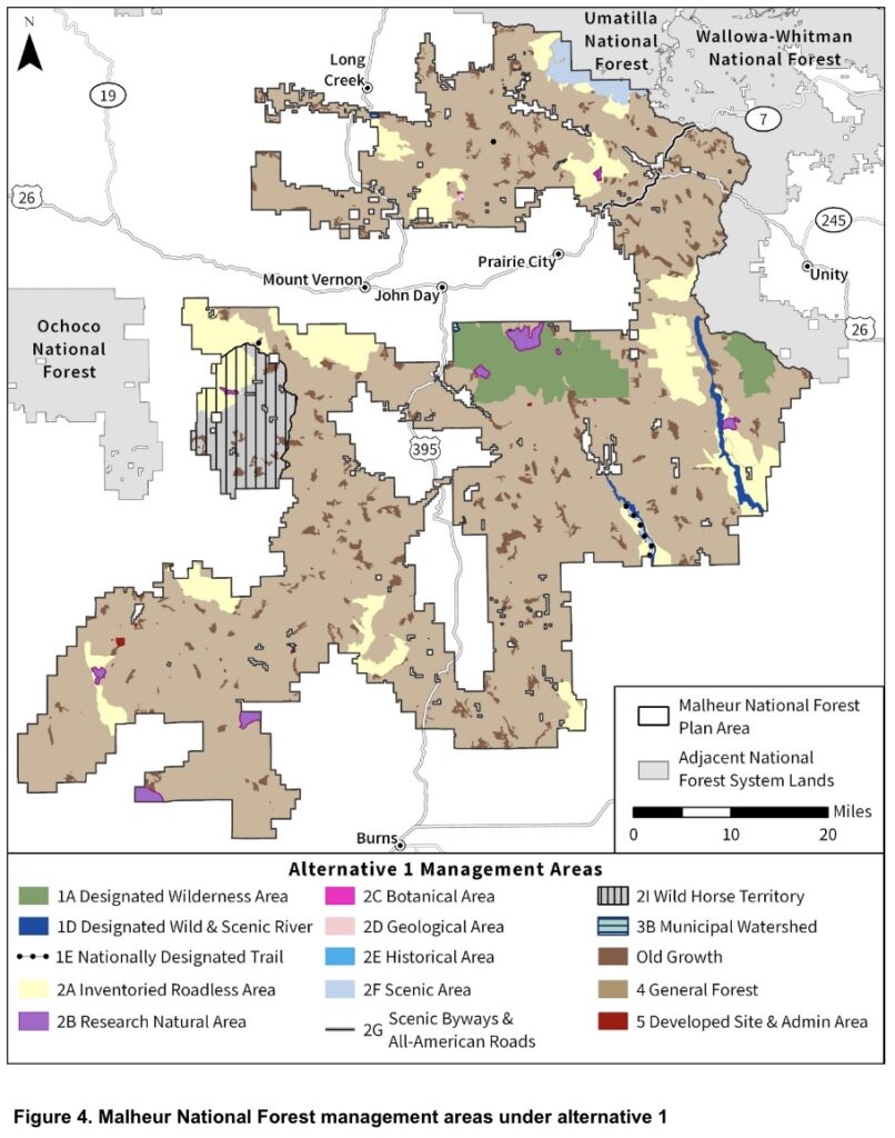
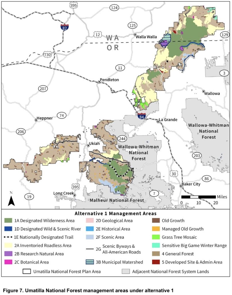
A related but separate issue is Wild & Scenic River eligibility. The DEIS identifies significantly more eligible river miles on the Umatilla National Forest — corridor mileage nearly triples from 62 to 166 miles — and that expansion applies under both action alternatives, not just Alternative 3. Eligible rivers carry interim protective management even before any formal designation, which is worth watching regardless of which alternative moves forward.
Take Action Below
Submit a comment using the tool below, add your own personal experiences and information if you have it to make your comment as strong as possible. Comments are due September 30th.