The National Park Service has proposed a short but consequential amendment to the special regulations governing off-road vehicle (ORV) use at Big Cypress National Preserve in Florida. Comments are due December 1, 2026.
What is being proposed
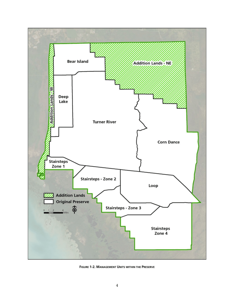
On October 2, 2026, NPS published a proposed rule (91 FR 62682; RIN 1024-AE54; Docket NPS-2026-0199) amending 36 CFR Part 7. The rule would replace two references in the existing regulations to the 1975 preserve map with references to a new map created this year, depicting the preserve's current boundary which should expand the area that ORV routes are allowed.
The change matters because Congress added approximately 147,000 acres to the preserve in 1988, north of Tamiami Trail, and the existing regulations still point to the pre-expansion map. As a result, the Superintendent has had no regulatory authority to designate ORV routes in the Addition. Under the proposed rule, the Addition would be open to ORV use on designated trails, with specific routes set through the Superintendent's Compendium.
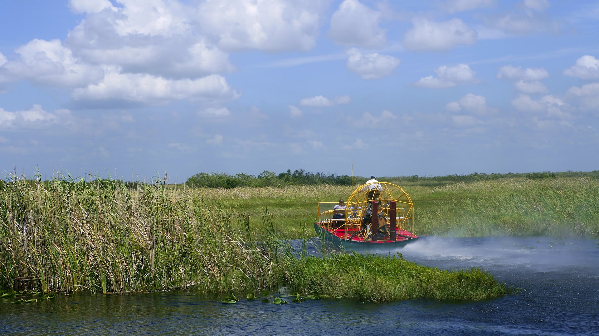
For regulatory purposes, ORVs include automobiles, trucks, glades or swamp buggies, airboats, and amphibious or air cushion vehicles.
Background
ORVs have been used in what is now Big Cypress National Preserve since the 1930s, when swamp buggies and similar vehicles opened country that was otherwise nearly unreachable. Congress created the Preserve in 1974 and protected traditional uses, and the National Park Service adopted ORV regulations for the original Preserve in 1979. In 1988 Congress added roughly 147,000 acres known as the “Addition.” The 1979 regulations rely on a map that predates it, and the Addition’s existing trails have been closed to public use since the NPS began managing the lands in 1996.
The path to reopening them has been long and contested. In 2006, an initial NPS assessment found about 111,600 acres of the Addition eligible for wilderness. After a draft plan drew nearly 17,000 public comments, the NPS reassessed in 2010 and concluded that existing ORV trails and a surrounding buffer carried a substantial human imprint. That cut eligible acreage to about 71,000, roughly 40,000 acres fewer than in 2006. The NPS finalized the Addition General Management Plan later that year, with a designated ORV trail network and a cap of 650 permits.
Conservation groups, including NPCA, PEER, the Sierra Club, and the South Florida Wildlands Association, sued in 2011. They argued, among other things, that the NPS had stripped wilderness eligibility from the trail areas to make room for ORV use. A federal district court rejected that claim in 2014, finding the reassessment was reasoned decision-making rather than political manipulation. In 2016 the Eleventh Circuit affirmed, holding that the NPS’s treatment of trails and buffers under the Wilderness Act’s “substantially unnoticeable” standard was reasonable, and that the plan complied with the Organic Act and the Endangered Species Act.
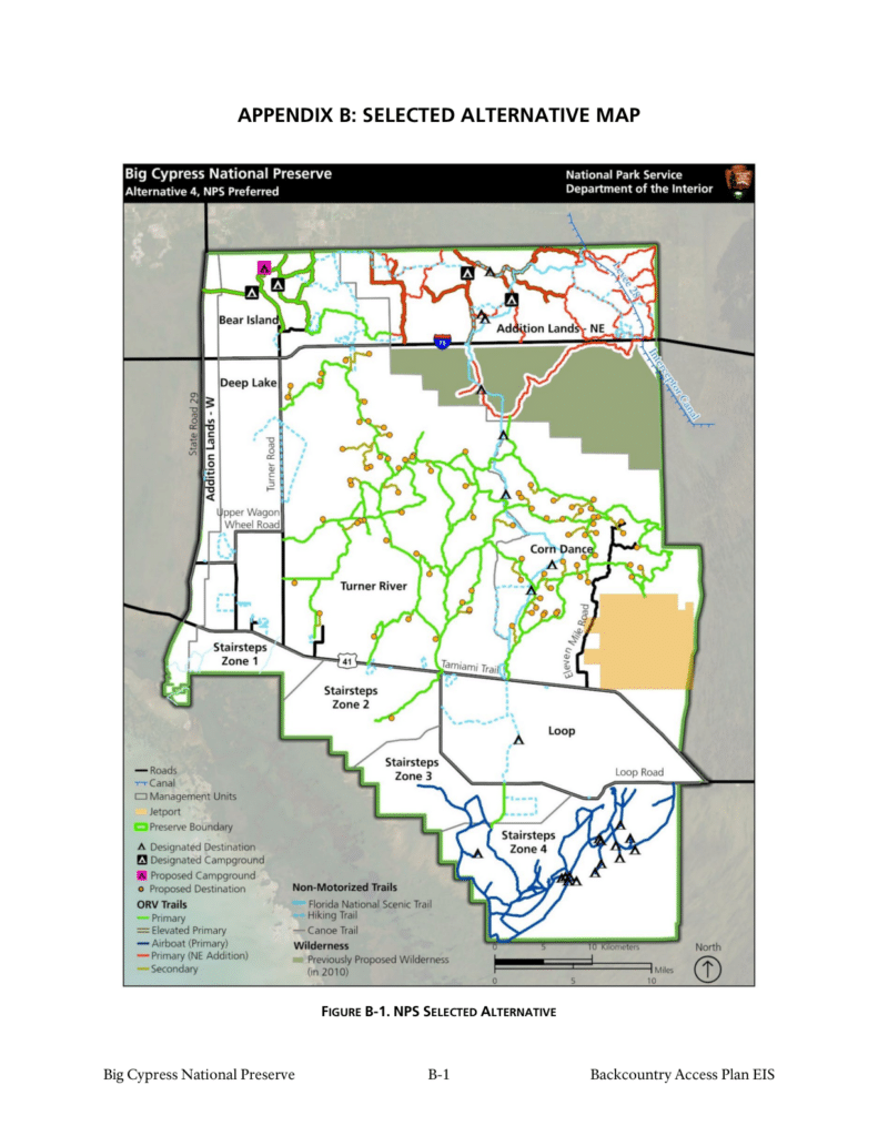
The proposed rule, announced October 1, 2026, would update the regulations to cover the Preserve’s current boundary. It would allow the Superintendent to establish the Addition’s designated ORV trail network using existing historic trails, after site-specific surveys. That is the step needed to carry out a plan that has been upheld in court and developed over multiple public comment periods.
The proposed rule follows NPS's Backcountry Access Plan / Wilderness Study / Final Environmental Impact Statement (November 2024) and the Record of Decision signed December 12, 2024. The selected alternative allows ORV use only on designated motor vehicle and airboat routes. NPS says it selected the alternative in part because it responds to concerns raised by the Seminole and Miccosukee Tribes during Tribal consultation. NPS consulted the Miccosukee Tribe of Indians of Florida, the Seminole Tribe of Florida, and the Seminole Nation of Oklahoma.
NPS has classified the rule as not significant under Executive Order 12866 and as a deregulatory action under Executive Order 14192.
What stays the same
The proposal does not change the existing restrictions elsewhere in the preserve. ORVs remain prohibited between Loop Road and Tamiami Trail (except for permitted resident and oil and gas access) and on specified segments of the Big Cypress Florida Trail. Existing equipment and safety requirements also remain in place.
Why it matters to BRC members
This rulemaking is the regulatory step that lets the 2024 Backcountry Access Plan take effect in the Addition. Without the updated map reference, the Superintendent cannot designate motorized routes there, so the plan's route network cannot be put on the ground. The outcome will shape how much of the Addition's backcountry stays open to motorized and airboat access, and the designations that follow will be made through the Superintendent's Compendium rather than through further rulemaking.
BRC supports responsible, managed motorized access on public lands, and a designated-route system is the framework through which that access is sustained. BRC will be reviewing the proposal and the underlying Backcountry Access Plan documents.
How to comment
Use the tool below to submit a comment directly to regulations.gov, please include any additional comments about the proposed project if you have them. Comments are accepted through December 1, 2026, 11:59 p.m. EDT. All comments made on regulations.gov action centers will be public comments, so we encourage action-takers not to include personally identifiable information in their messages.