Enter to win custom GasGas Dirt Bike + Moab Trip! Click Here

Lost Trails Guidebook #22 | Trail Canyon, UT | Canaan Mountain | BLM Route 10G

Sep 6, 2022

Why you should submit here, even if you already have elsewhere!

We keep them honest. If everyone only comments through the government/agency site, we have to take their word on how many comments were received. By submitting through BRC, we create an independent record of our community’s response that can’t be buried or under-reported.

We protect your voice. If this fight ends up in court, having our own record of submitted comments means we don’t have to wait a year or more for a government agency to turn over documents. We can move quickly with proof that thousands of you spoke up.
We keep you in the loop. When you comment through our site, we can send you updates on what comes next. If you only use the government/agency site, you’re depending on them to tell you what happens next — and they won’t.

Double coverage matters. Even if you’ve already commented through the government/agency site, submitting through ours makes your voice count twice — once in their system, and once in ours. That way they know the OHV community is watching and tracking every move.

For years, BRC has been trusted to run action alerts like this. Thousands of members and supporters have used this system effectively to defend access to public lands. This isn’t about collecting your info — it’s about building the strongest, most transparent record possible to hold agencies accountable.

Why you should submit here, even if you already have elsewhere!

We keep them honest. If everyone only comments through the government/agency site, we have to take their word on how many comments were received. By submitting through BRC, we create an independent record of our community’s response that can’t be buried or under-reported.

We protect your voice. If this fight ends up in court, having our own record of submitted comments means we don’t have to wait a year or more for a government agency to turn over documents. We can move quickly with proof that thousands of you spoke up.

We keep you in the loop. When you comment through our site, we can send you updates on what comes next. If you only use the government/agency site, you’re depending on them to tell you what happens next — and they won’t.

Double coverage matters. Even if you’ve already commented through the government/agency site, submitting through ours makes your voice count twice — once in their system, and once in ours. That way they know the OHV community is watching and tracking every move.

For years, BRC has been trusted to run action alerts like this. Thousands of members and supporters have used this system effectively to defend access to public lands. This isn’t about collecting your info — it’s about building the strongest, most transparent record possible to hold agencies accountable.

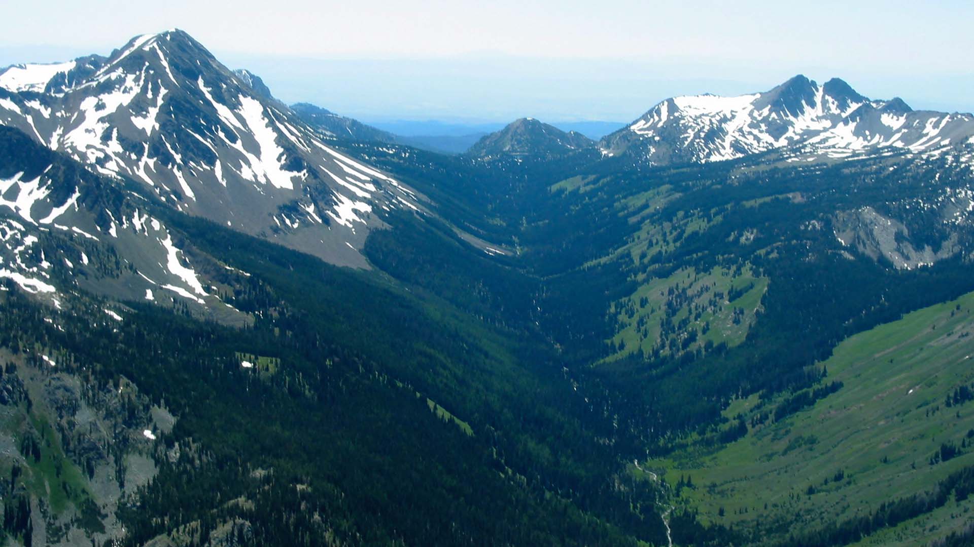
Overview: The Trail Canyon Travel Management Area includes terrain between Zion National Park and the Coral Pink Sand Dunes. The landscape is part of the Greater Zion Area, and has all the features that attract people to Utah’s most popular National Park. Iconic sandstone formations, a wide variety of desert wildlife and plants, and memorable trails that offer a broad range of options for adventure. The Trails in this area are mostly sandy dirt roads that require capable off-road vehicles.

YouTube video

Getting There: BLM Route 10G branches off of South Virgin-Sands Road (also referred to as Shunsburg Maildrop-Warrior Walk Loop) to the southwest at GPS coordinates 37° 3′ 44.9634″ and (also known as Cat Canyon Road) at GPS coordinates 38°47’6.72 and -112° 51′ 0.8274. This is one of the few roads that will give you access to the Canaan Mountain Wilderness. The road is open to a point where you run into a blockade, but maps show the road continues on passed the blockade to what is likely a scenic overlook of a sandstone box canyon.

The trail after the blockade is clearly visible on the ground and not reclaiming. While it does travel through a wilderness study area, if this area were to ever be designated as wilderness, it is likely this road would be included through a cherry stem. While the route provides scenic views and an enjoyable riding experience, we would like to see it reach the overlook. We have requested the BLM include this route in their inventory in the travel management process with hopes it will be opened. We encourage the public to become familiar with this route, so you can become part of the story to keep it open and accessible. For now we recommend exploring the area beyond the barricade on foot.

Route Conditions: BLM Route 10G in the Trail Canyon area is accessible by any 4WD OHV. It does involve s decent gain in elevation, and the trail is compacted sand that is typical of trails in the area.

As always, follow LEAVE NO TRACE practices. Don’t go around the barricade. We will work to get the remainder of the trail open through the official process.

This route report is part of a larger guidebook BRC is completing to educate users about high-value motorized trails that are at risk of closure if we don’t use them. This guidebook will be called the Lost Trails Guidebook, and has been funded by a generous grant from the Yamaha Outdoor Access Initiative with Jorgensen Powersports as a sponsoring dealer.

Appreciate What We Do?

It takes a team of people to investigate, review, advocate and litigate in order to protect your rights to public lands. Please consider donating today so we can defend your ground.

Latest Articles

Categories