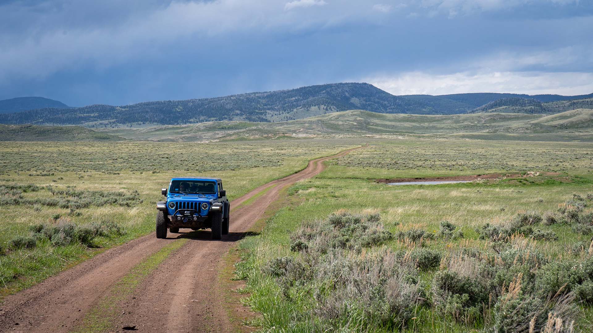
The BLM is accepting public comment on the Dinosaur North Travel Management plan through July 22, 2026. The Dinosaur North TMA spans northern Uintah and eastern Daggett counties, covering 344,822 acres adjacent to Dinosaur National Monument. The route network — approximately 700 miles of roads and trails — provides hunting, OHV, and backcountry access that the communities of Vernal, Roosevelt, and the surrounding Uinta Basin depend on. Many of these routes predate federal land management authority entirely.
This TMP is being reviewed because anti-access groups sued the BLM and won a 2017 settlement requiring travel planning across 13 Utah TMAs — not because the routes were illegal, but to get a second chance at closures. Wilderness groups have already used this process to close over a thousand miles of routes (interactive map) across southern Utah. Dinosaur North is one of the remaining plans in the queue.
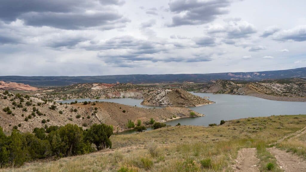
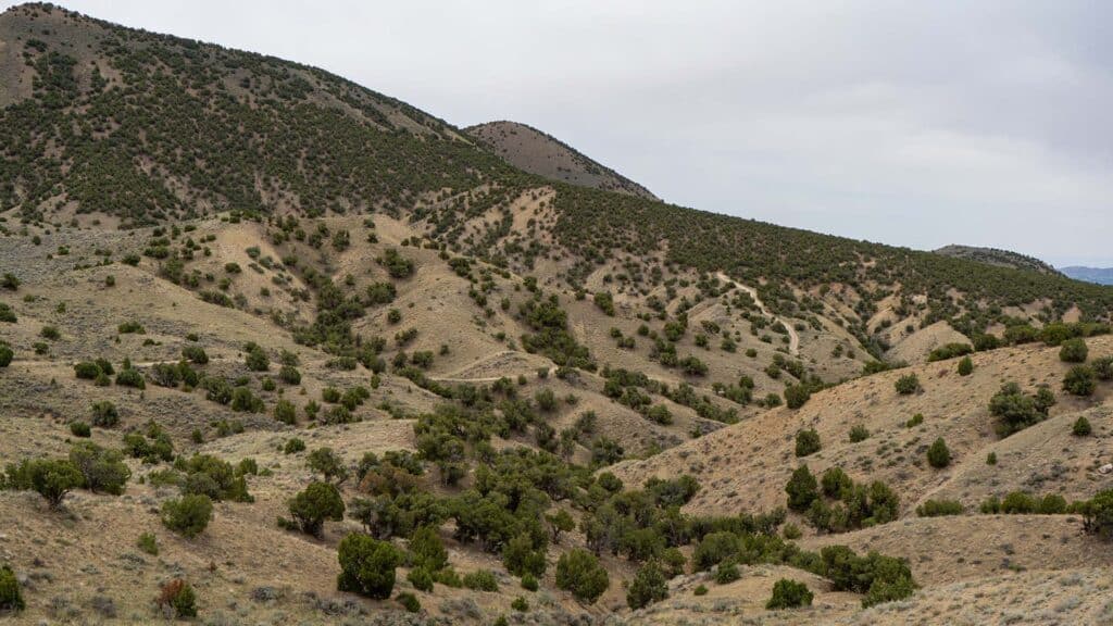
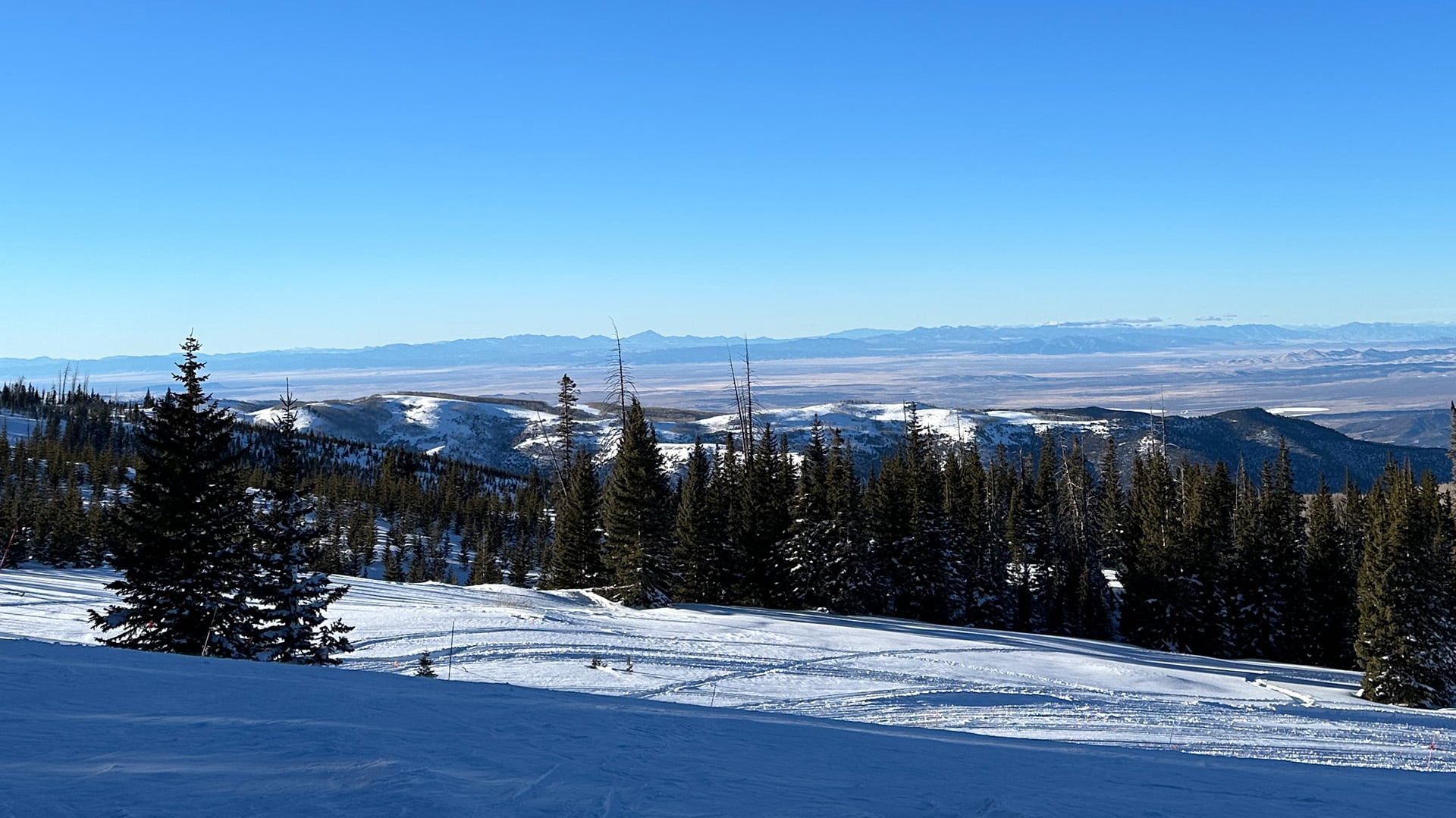
Images courtesy of Trails Offroad.
The Alternatives
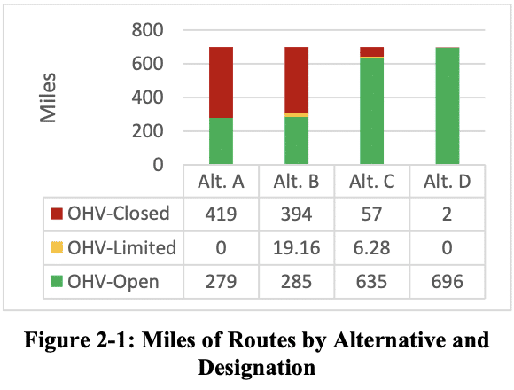
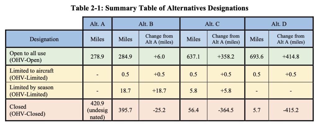
The BLM is analyzing three alternatives to current management. The 2008 RMP formally designated only 279 miles as OHV-Open. The remaining 420 miles were never formally designated but have remained in continuous use — making Alternative A far more restrictive than its "no action" label suggests.
Alternative A (No Action) continues the 2008 TMP designations. Despite the "no action" label, it would close 420 miles currently in active use — all LWC (Land with Wilderness Characteristics) routes and all but 16 miles of BLM Natural Area routes — simply because those routes were never formally designated in 2008.
Alternative B (Conservation) is the preferred outcome of anti-access groups. It closes 396 miles, opens only 8 of 108 BLM Natural Area miles and only 2 of 32 LWC miles, and eliminates most backcountry access. This is not a compromise — it is a blueprint for dismantling motorized access under the guise of resource protection.
Alternative C (Balanced) opens 91% of the route network, including 29 of 32 LWC miles and 99 of 108 BLM Natural Area miles. It is a significant improvement over the 2008 baseline, but note that many of these additional routes are in 2008 OHV-Closed areas and would require a concurrent RMP amendment to implement.
Alternative D (Access) opens 99% of the route network — consistent with how this land is actually being used today and with Executive Order 14408, which directs BLM to remove unnecessary restrictions on federal land access. Like Alternative C, routes in 2008 OHV-Closed areas require a concurrent RMP amendment. BRC supports Alternative D.
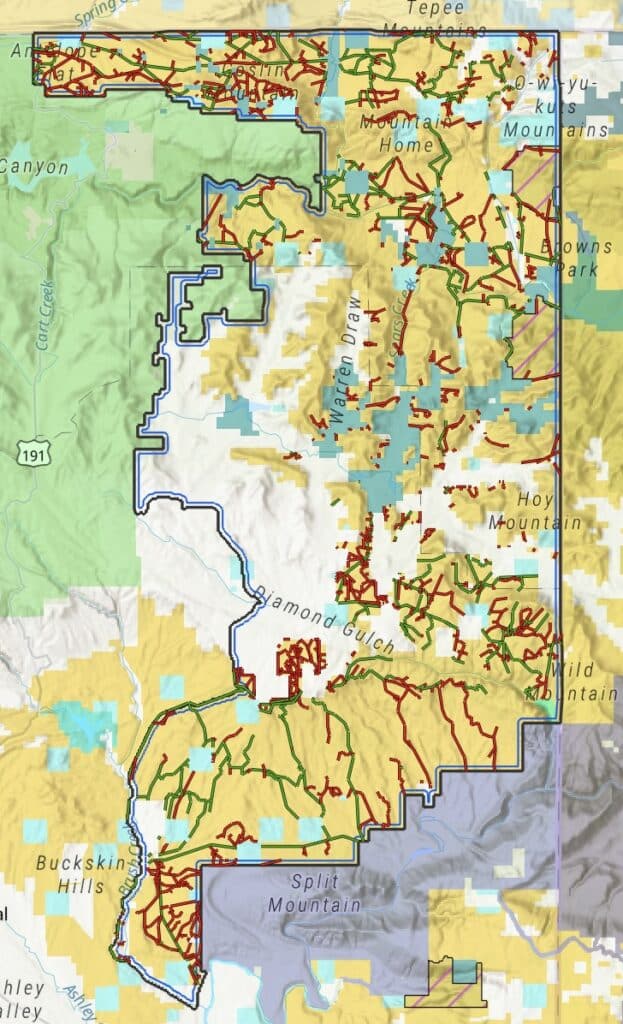
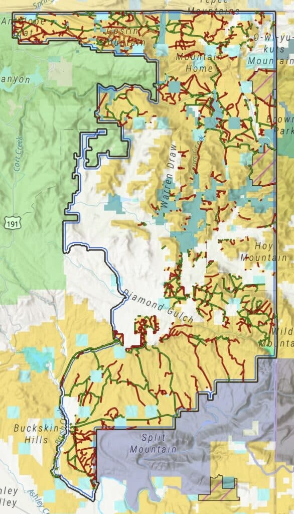
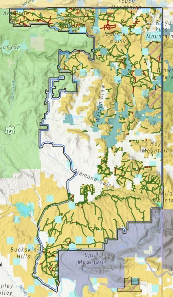
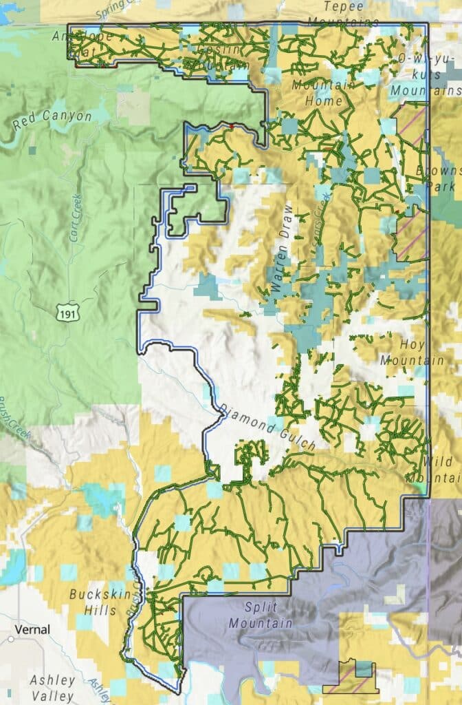
(click to enlarge)
BRC's Concerns
Routes were originally left out of the 2008 RMP because of restrictive land designations such as LWC's (Lands with Wilderness Characteristics), ACEC's (Area of Critical Environmental Concern), WSA's (Wilderness Study Areas), Natural Areas, etc. Routes are still proposed for closure officially through this planning process because they lay within these areas or lead to them.
Lands with Wilderness Characteristics (32 miles): All 32 LWC miles were undesignated in 2008 and have been in continuous use. Alternative D opens all of them. Alternative B opens only 2 miles — barely above Alternative A's zero.
BLM Natural Areas (108 miles): The TMA contains 7 BLM Natural Areas with 108 miles of routes. These are discretionary RMP decisions — not congressionally designated Wilderness — and can be changed through a plan amendment. Alternative B leaves only 8 miles open (7%). Alternative D opens all 108 (100%).
Wilderness Study Areas (7 miles): Diamond Breaks and West Cold Springs are Section 603 WSAs with 7 miles of routes. The EA states these routes are "not eligible to be carried forward into a decision" without a formal plan amendment, regardless of alternative.
Browns Park ACEC (53 miles): Alternatives A and B are essentially identical here — both keep 25 miles open and close 28. Alternative D opens all 53.
Green River Access: Only 7 of 27 Green River access routes are open under Alternative A. Alternative D opens 26 of 27.
Alternatives C and D require a plan amendment. The EA states that BLM "cannot allow motorized use on routes in the 2008 RMP OHV-closed areas without a plan amendment." BLM must commit to pursuing that amendment concurrently with the TMP decision. EO 14408 provides the policy authority to do it.
Alternative A is not a true status quo. Selecting it would close 420 miles currently in active use. The real baseline is on-the-ground conditions, not the 2008 TMP's unenforceable paper designations.
The conflict minimization standard is misattributed. The EA attributes the obligation to minimize user conflicts to FLPMA — it actually comes from 43 CFR 8342.1. The EA also acknowledges that conflict in this TMA is assumed, not documented: "BLM assumes user conflicts may occur throughout the TMA." Assumed conflict is not a valid basis for route closure.
BRC's Bottom Line
BRC supports Alternative D. Select it, pursue the RMP amendment, and protect the access that Uintah Basin communities have relied on for generations. Alternative B would hand wilderness groups exactly what it spent a decade in court pursuing. Submit your comments using the tool below and include your own personal message of why opening these routes is important to you.