
Recently, the Bureau of Land Management announced that they would be reassessing a substantial portion of the routes that were closed in Moab’s Labyrinth Rims/Gemini Bridges Travel Plan. This is a major step forward in our fight to get these trails reopened. As part of this process, they have opened an additional comment period to gather public feedback on the routes they plan to reassess.
In all, they are reassessing about half of the routes that were closed. The best way to see which routes are affected is to review the BLM’s Interactive Map. The image below shows a portion of this map where the green and pink routes are being reassessed. Orange routes are proposed to remain closed.
We need all of our supporters to add their voice to this process, and we want to do everything we can to make sure your voice is effective. First and foremost, we encourage you to submit your comments through BlueRibbon’s action alert tool.
While these comments all go directly to the BLM, when you submit through our tool, we have access to the information. This gives us visibility into the comment volume and content, so we can help our community be more effective during the comment period. It helps us draft better comments knowing what the BRC community is saying. This information is also important for any subsequent legal work that might be necessary, so we don’t have to wait for months or years for the BLM to produce the public comment record through legal discovery. When you bypass our tool and submit a comment directly to the BLM, you give them all the information and leave us essentially blindfolded as we gear up to fight for our trails.
While our tool makes it easy to submit a form comment to the BLM, it is always important to customize your comments. In the case of these Moab trails, we need everyone to be submitting comments about the specific routes they want to see open. We want to give you a guide for how to make a good route-specific comment.
It’s important to point out that the routes are still closed during this reassessment period, so you can’t actually go review them on the ground in a vehicle. You could walk them on foot or use a drone to survey them if you have plans to travel to the area. Otherwise, you should focus on trails that you used in the past and base your comment on your previous experience.
Here is a step-by-step example:
Step 1: Find a Route to Support

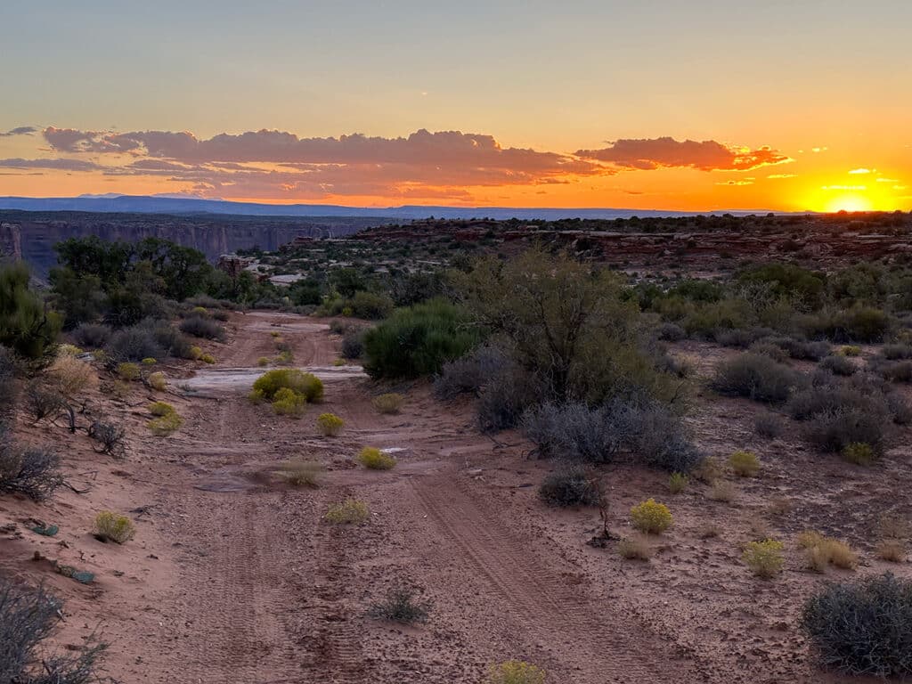
From the interactive map, we are seeing that route D1026B is green, so it is being reassessed. I focused on this route because I’ve explored it in the past. It goes to an amazing overlook of Taylor Canyon, which is part of Canyonlands National Park.
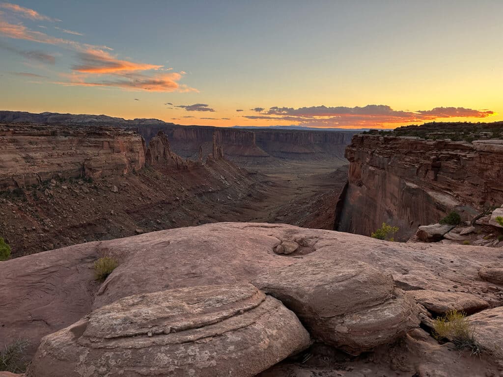
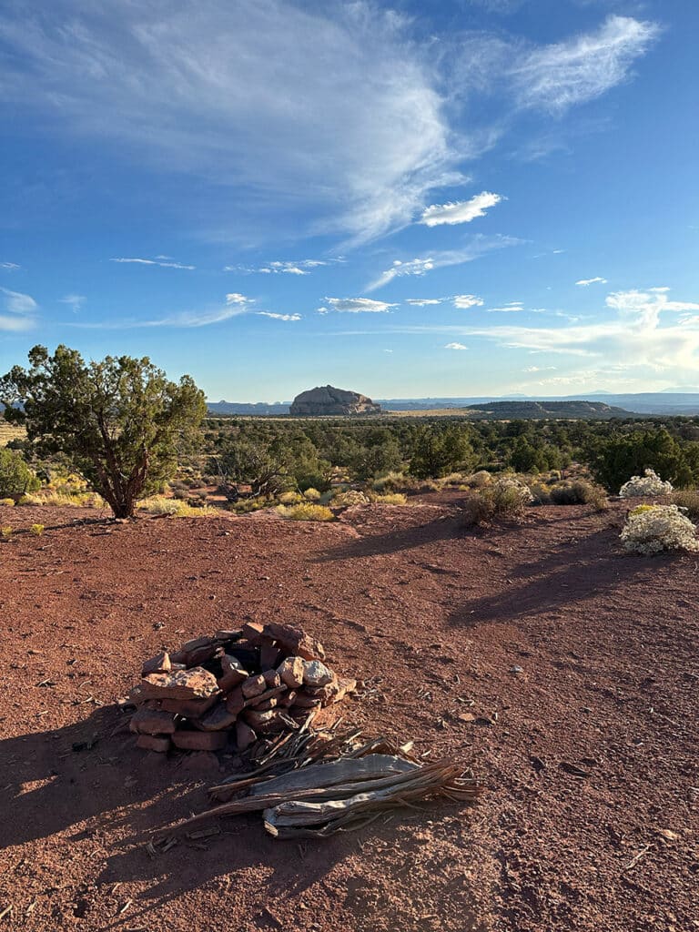
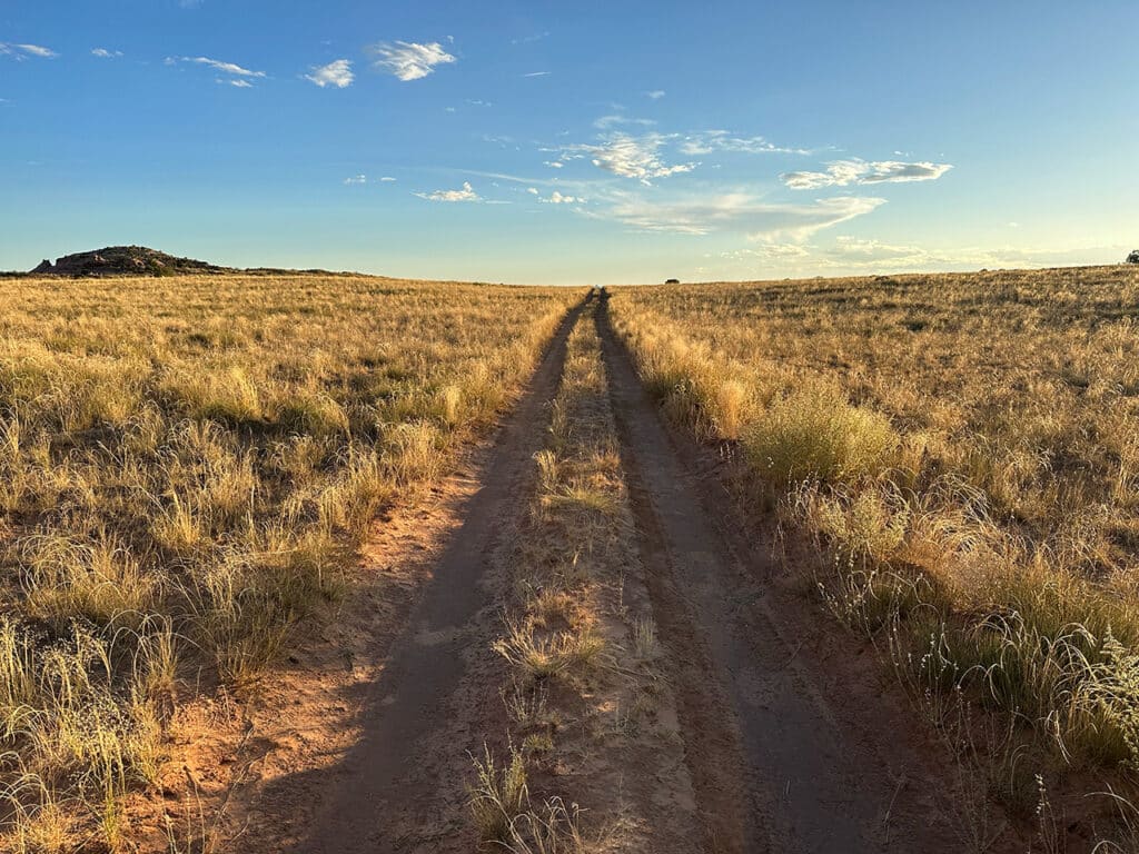
The route itself also includes a variety of terrain. There are pullouts with scenic dispersed campsites along the way. It crosses open grasslands. There are scenic sandstone formations. The trail includes a few small sandstone features and ledges in the trail itself, but nothing that a stock high-clearance vehicle can’t handle.
All of these characteristics I’ve described showcase the recreation value of this route. And this is the first thing you should focus on in your comments: Explain why you enjoy recreating on these routes or why you would like to explore these routes.
Step 2: Find the BLM’s Previous Rationale for Closing the Route
In the Decision Record from 2023 when BLM decided to close these routes they provided a table of all the routes in the area with the justification for closing the routes that were closed. You can find this table by clicking here and scrolling to Attachment 2. I scrolled down to find route D1026B, and this is the rationale they provided to close this route:
D1026B is closed to motorized use; it is a 2.18-mile-long spur that terminates at the National Park Service boundary. Closing D1026B minimizes impacts to grasslands, salt desert shrub and blackbrush communities, desert bighorn sheep habitat from OHV use, and contributes to retaining soil cover. Closing D1026B minimizes the impacts of D1042A. D1026B provides access to a SITLA section, and will not be actively reclaimed.
Step 3: Provide Justification to Reconsider Their Previous Rationale
Based on this justification we are seeing that BLM thinks that they need to close this route to justify leaving D1042A open. In some cases you will see them call this route “redundancy”. In our comment we would argue that D1042A provides a very different recreation experience than D1026B, which is true, since D1042A doesn’t lead to an overlook with a unique scenic viewpoint. D1042A is a mile away from D1026B, and in this terrain that is far enough that the users from each trail wouldn’t be able to see each other. As a result, leaving both routes open allows users to disperse across the landscape instead of concentrating impacts.
The vegetation impacts that are cited are minimized by the fact that the trail already exists and the grass, salt desert shrub, and blackbrush are abundant throughout the vicinity of the route. There is no evidence that the use of this route has caused any significant impacts to these plants. There is no evidence of soil impacts outside of the minimal disturbance of the already-existing route itself.
If you want to go the extra mile, you can download the BLM’s individual route reports and review their deeper analysis of the route. This folder is 647MB and is over 1000 pages of documents, but the information is important. Each route has its own specific report in the folder. From this report we learn that BLM had originally determined to leave this route open either for public access or administrative access in all four of the alternatives that it proposed during the development of this plan. It analyzed the impacts to all resources that would occur from leaving this route open, and this was their conclusion:
Allowing continued use of this route would minimize potential impacts to documented resources by concentrating motorized use (rather than dispersing it) on an alignment capable of accommodating the route’s anticipated traffic volume. Allowing continued use of this existing route, which provides the best access to range improvements, would minimize the potential for new disturbances to documented resources from cross-country use or the need for construction of new routes to provide similar access. This route provides primary access to State and/or private property and its use may or may not minimize potential impacts to documented resources. Continued use of this route would minimize conflicts among various users of public land by providing access to other public land areas beyond the urban interface, reducing user concentrations and the potential for impacts to documented resources within the urban interface. Due to the low traffic volume and speeds expected on this route, allowing its continued use would contribute to minimizing the overall route network’s potential for causing undue and unnecessary soil erosion, habitat disruption and/or vegetative damage. By providing a critical trail connection that would minimize the inclination to travel off-trail, potential impacts on T&E species and their habitats would be reduced.
In this case we can encourage the BLM to rely on its own analysis, which suggested that the route could be maintained as open and still minimize the impacts that were used to justify the closure. We believe you will find with most routes that the BLM has already developed analysis that justifies opening all of the routes they propose to close.
Step 4: Do This Again For Your Favorite Routes
In our experience users enjoy different routes for different reasons. So if everyone goes and advocates for their favorite routes we will get a lot of coverage. If there is a route that you have used in this area that is still marked in orange on the map instead of pink or green, we still encourage you to tell the BLM to include other routes in their reassessment. We believe if they receive strong public feedback for routes that weren’t included to be reassessed we have a chance in getting them reopened.
Remember we only have until October 24 to submit comments. If you care about these trails we hope you’ll take the time to create a strong record supporting these routes through route specific comments that the BLM can use to justify reversing their decision to close them.


